Geocoding tuned for agency address books.
Address standardization and verification at the precision needed for tax rolls, citizen services, and public records, including rural, multi-unit, and parcel-level geocoding.
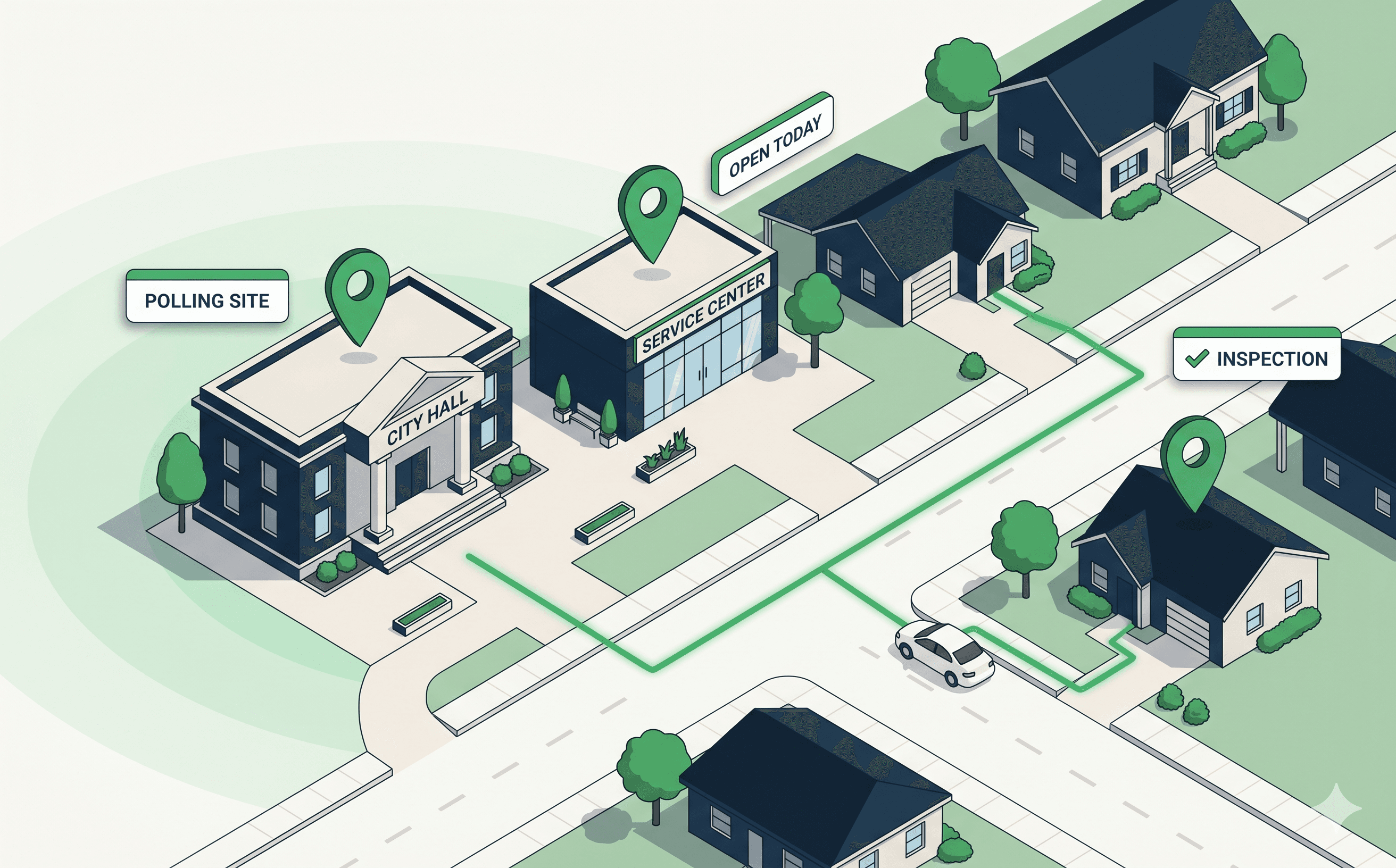
Address standardization, multi-stop routing for inspectors and field teams, drive-time service-area analysis, and citizen-facing locators, built for federal, state, and local government.
Trusted by federal, state, and local agencies across the United States.


Address standardization and verification at the precision needed for tax rolls, citizen services, and public records, including rural, multi-unit, and parcel-level geocoding.
Multi-stop sequencing for code-enforcement, building, health, environmental, and assessment field staff, built so visit days finish on time.
Drive-time isochrones for transit planning, facility-siting decisions, equity-of-access audits, and emergency-response coverage, grounded in real road-network data.
Branded locators for libraries, polling places, transit stops, recreation facilities, and service centers, built to scale with citizen-facing traffic spikes.
Address verification across millions of records, citizen-facing locators that spike on Election Day, and field-team routing across thousands of inspectors, per-call pricing breaks the budget. Our model is built for the volumes agencies actually run.
Most agencies already run ESRI, open GIS standards, or in-house tooling. Our APIs sit alongside that stack, not in place of it, using the formats and protocols GIS teams actually work with.
Public-sector teams get dedicated technical support and account management. When a citizen-facing locator spikes on Election Day or a field-team integration breaks during a regulatory deadline, there's a human on the other end.
Address quality is a citizen-services problem before it's a data problem.
Wrong addresses don't just produce bad analytics, they produce returned mail, missed inspections, missed benefits, and citizens who fall through the cracks. The agencies we work with that fix geocoding at intake clear more cases and reduce exception-handling later.
Service areas drawn on lines aren't service areas.
Coverage maps drawn on jurisdictional boundaries can hide real gaps: residents who live in-district but can't reach a service location in a reasonable drive. The agencies that move to drive-time isochrones grounded in real road data find the gaps before audits do.
Inspectors lose their day to addresses, not roads.
Field inspectors don't lose hours to traffic, they lose hours to addresses that don't resolve, parcels that look like the wrong unit, and back-lot entrances that aren't on the map. The agencies that fix this on the work-order side recover the day before the route does.
Want the deeper technical view? Read our public-sector routing and geocoding guide →
Volume-based pricing designed for the call patterns agencies actually run, address verification, locators, field routing. Talk to sales for procurement-vehicle availability (GSA, NASPO, state contracts) and a per-program TCO comparison against your current provider.
We support customers operating under common public-sector compliance regimes. Our APIs do not require sensitive citizen data in the request payload, addresses and coordinates are sufficient for verification, geocoding, and routing. Talk to sales for current compliance posture, data-residency options, and DPA discussions.
Our APIs and tile formats coexist with ESRI ArcGIS and open GIS standards (OGC, WMS, WMTS, vector tiles). Most public-sector customers run our routing, geocoding, and isochrones alongside their existing GIS investment, not in place of it.
Yes. Tile and search infrastructure are built for traffic spikes, Election Day polling-place lookups, severe-weather shelter searches, and similar surge events. Talk to sales for surge-capacity planning.